Chile Travel and News | By Raul Silva M.
 |
| Image: JC Outdoor Chile on YouTube |
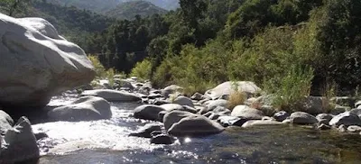
Río Clarillo National Park is a must-visit destination for nature lovers and anyone looking to escape the hustle and bustle of Santiago. With its stunning scenery, diverse flora and fauna, and convenient location, it's the perfect place to spend a day exploring and enjoying the great outdoors.
Rio Clarillo was declared a National Reserve in 1982. Over the years it became a focus of visitors, receiving more than 100,000 people per year. As of September 2020, it can be visited as the first National Park in the Metropolitan Region, very close to Santiago.
The re-classification of the reserve was part of the proposals of the National Forest Corporation (CONAF), an institution that manages the National System of State Protected Wild Areas (SNASPE).
In this way, as of September 2020 Chile has more than 18 million protected hectares, distributed in 43 National Parks, 45 National Reserves and 18 Natural Monuments, not for nothing in 2019 Chile was awarded as the World's Leading Green Destination by World Travel Awards.
Main Features of Río Clarillo National Park
 |
| Image: conaf.cl |
The protected area is located in the foothills of the Pirque commune, southeast of Santiago, just 45 km. from the center of the Chilean capital and 23 km. from Puente Alto. It comprises 13,185 hectares with altitudes ranging between 850 and 3,500 meters above sea level. Its main attraction is Clarillo River, which supplies water to the nearby communities of Pirque and Puente Alto.
Flora and Fauna: The place is key since it is a refuge for the Cipres de la Cordillera (Austrocedrus chilensis, an endangered species), and one of the last areas with sclerophyllous forest near Santiago, mainly formed by species such as the Peumo, Litre, and Quillayes. The park is also home to a variety of animal species, including the endangered Woodpigeon, the Chilean Iguana, Foxes, Condors and many others.
Three types of ecosystems are present in the place: the high Andean steppe, the Andean scrubland and Sclerophyllous forest, which has strongly diminished. Scientists from various universities come to Rio Clarillo to study ecosystems.
* Hiking Trails: The new National Park has several hiking trails, including Quebrada Jorquera, Aliwén Mahuida, Arboretum, Trikau, El Peumal, Rincón de los Bueyes. In addition, Rio Clarillo is a park considered inclusive, where there is infrastructure for people with special needs. It has equipment such as circuits, bathrooms, picnic areas, viewpoints and access to the river in El Maitén area. You can also go trekking and walk the trails to take pictures.
Rio Clarillo National Park is open from Tuesday to Sunday, from 8:30 am to 5:00 pm (entrance allowed only until 1:00 pm). All visitors must reserve their tickets at pasesparques.cl
How to Get There
Under normal weather conditions, the place can be visited year-round.* By Car: You can rent a car in Santiago and drive to the park. The journey takes about an hour and covers approximately 45 kilometers. The route involves taking Avenida Vicuña Mackenna, which becomes Avenida Concha y Toro in the Puente Alto commune, then crossing the Maipo River to reach the Pirque commune.
* By Public Transportation: If you prefer public transportation, you can take the subway to the Las Mercedes station in Puente Alto and then catch a bus to the park. Buses from the subway station will drop you off about 4 kilometers from the end of the dirt road leading to the park.
You can also get to the Plaza de Puente Alto subway station and take the Pirque - Río Clarillo bus, which will drop you near the entrance.
Summer, when the area is highly visited, is very hot, with more than 30º C. It is important to hydrate well and protect yourself from sun damage.
Comments
Post a Comment